Taxonomy upgrade extras
San Jose, California
Words by Lars Thomsen
Photos by Ross McMahon
San Jose is a city in shadow. Office buildings dominate the landscape; blank, under populated shells left over from the dot-com boom and bust of nearly a decade ago. It seems impossible to discuss San Jose without mention of its far more infamous neighbor, Palo Alto—the dry sandy home of illustrious Stanford University and venture capitalism. But when it comes to mountain biking on the West coast—and even more specifically in California—San Jose is never mentioned in the same sentence as giants like Fontana, Soquel, Marin county, or Northstar. It’s overlooked, and that’s just how riders in San Jose prefer it.
Within striking distance of money-jostling investors and trendy internet companies—and in a county park, no less—twisted trails switchback and groove through a serpentine soil ecosystem full of native grasses, Indian Paintbrush, lupine, poppies, oak trees, maple and sage brush. I’ve seen wild turkeys, rabbits, rattlesnakes, tarantulas, deer, coyote, red tail, turkey vultures, owls, and even a mountain lion. On the southern fringe of Silicon Valley, the wild nature of Santa Teresa seems nearly out of place.
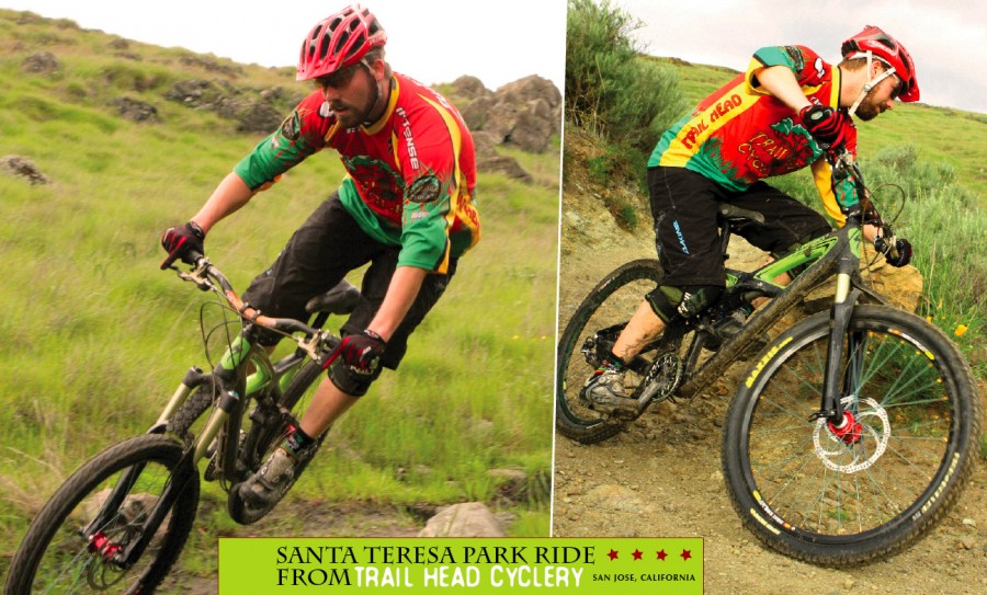
Most will agree that the best trail in Santa Teresa is called Rocky Ridge. This aptly named gem branches off of Coyote Peak, coughing up fast and narrow singletrack that starts with a smooth line up top and gradually gets rockier and more technical as you descend into a valley. Some folks ride around most of the rocks, but those with a keen eye and good bike handling skills can connect the dots and skip over them to form a race pace run. Often, a prevailing north wind makes you work harder for the flow, but on the rare days that garner a tailwind, you can fly. Near the bottom of this two-mile run is a fast turn onto a wide wooden bridge that slams you into a short, ass-kicker of a climb just to see if you’re still paying attention. I’ve heard many a drive train grind to a halt here, listening to the sound of a chainsaw cutting through wood into metal while a rider hunts for an easier gear. From the crest you can look back and heckle your pals for good measure, and then it’s a roaring off-camber descent to finish off the run. I’ve given up on tubes or thin sidewall tires here; they are eaten for lunch. On one particularly gory day, I fixed three snakebite flats one after the other, while my buddy fixed two. Do yourself a favor: go tubeless.
The other favorite trail is officially called Stiles Ranch, but most folks just know it as “that switchback trail.” It’s not a very inventive name, but you don’t usually have enough oxygen left for creativity after tackling 17 switchbacks in just 1.6 miles. Some of the trail is smooth and open, while most of it is littered with serpentine sections full of rocks. It’s most challenging when ridden from the South end; I’ve seen many riders get a gleam in their eye as they remember the first time they cleaned it. Not all the lines are obvious, either. In one particularly notorious section, you come ripping into it on the main line and will surely shovel dirt in the turn if you stay there; to the left is a big rock outcrop that you can rally up onto, then drop steeply into the apex and braaap, you’re flying again. On a hot day, the sage smell overwhelms the senses, distracting your focus but adding to the sparse, desert flavor of the place. This trail is great in either direction with nearly equal climbing and descending, but clearly the favorite route is to ride south from the Mine trail.
Rocky Ridge and Stile are great technical challenges, but they’re also pretty short. I prefer to tie those together with another easier, buff trail called Ohlone for a lengthier figure eight loop that makes you earn your downhills. This route is about ten miles, and will take a good two hours if you’re strong and you don’t stop much.
Starting from the main parking lot in the center of the park, pick up the Hidden Springs Trail on the northern side of the lot. (To skip the parking fee in the main lot, use the small lot on Bernal west of Trench Hill.) Take a left, and then ride up and down to the Ohlone trail. If you hit Bernal Road, you just missed your right turn. Ohlone will fly a bit, climb a tad, and then fly some more. This hill-hugging trail is quite buff, winding through oak trees and grasses. When you reach the golf course, go right. Ohlone continues up and then left skirting the players in their goofy v-necks. Heckling golfers is good fun, but at the next jeep road be sure to go left and then stay right or those golfers will get you. Ohlone drops in again on the left for a nice one-mile out-and-back ripper. Backtrack to the Coyote Peak Trail and climb it to the top. Yes, this climb blows. But it’s a not any easier to take Boundary Trail; like a tempting desert mirage, it appears to be the less tiring route. Trust me, it’s not.
From the top, bomb south of the peak on Coyote Trail and hold your line through the high-speed kitty litter. Two short climbs and you’re on top of Rocky Ridge. Drop your saddle, but don’t forget about that ass-kicker climb towards the end. When you exit Rocky Ridge, hang left on Mine Trail and then take a quick right to stay on Mine. There’s a short climb, then a quick descent to bear left into Stiles Ranch.
Stiles will climb a few switchbacks, crest into a short downhill of switchbacks, across another bridge and up a couple more switchbacks. After all 17, I’m usually saying a quiet hallelujah for my Gravity Dropper seat post. You get another great view and then a super fun descent with more switchbacks in some deep sage. Swing left into Fortini trail, which rolls and climbs back to the Mine Trail and then you’re off to your car, driving back into the shadowy shelter of the city.