Taxonomy upgrade extras
Words & Photos by Tommy Reagh
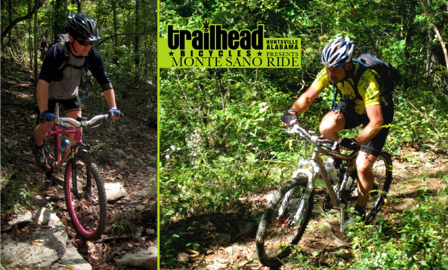
HUNTSVILLE, ALABAMA
There’s something special about this place. It’s hard to put a finger on but it’s tangible. The Chickasaw and Cherokee believed the multitude of springs here produced water that had healing powers. Evidently, so did the first settlers of north Alabama. Monte Sano, Spanish for “Mountain of Health” has attracted visitors hoping to find a cure for what ails them since the 1820’s. This eventually brought about the establishment of the town of Viduta, a derivative of the Spanish word “Vida,” meaning life. Flash forward nearly two hundred years and folks around here are still living the good “vida” but now on two wheels — rolling, carving and dropping in on the fifty miles of rocky, rooty single track that drapes the mountain like a spider web. All of which is only a ten minute drive from downtown Huntsville.
There are two public land holdings on Monte Sano that encompass the majority of the trails; these are Monte Sano State Park and the Huntsville Land Trust’s Monte Sano Preserve. Though they’re separate spaces on paper, their trail systems are interconnected. The terrain can be quite demanding with lots of steep, technical ups and downs that are littered with baby head rocks. The best description I’ve heard is from a rider who claimed, “I felt like I was strapped to an ass-whoopin’ machine and somebody had dumped in a whole sack-load of nickels.”
So you’ve got a penchant for a little two-wheeled masochism and this all sounds like a little piece of heaven. Well, let’s get right down to the real nitty gritty. The trailhead of choice for locals is atop the mountain in the State Park where maps of the whole mountain, including the Land Trust trails can be picked up for $2 at the “Country Store” next to the Ranger’s Station. The trails are well marked but, due to the multitude of intersections, a map isn’t just a good idea it’s a necessity. Another necessity is Ivy Block and or some shin-high socks. In the deserts out west, you don’t want to get off the trail or you’re in cactus needles. Here, you’re in poison ivy…the only other plant in the area that’s as abundant as kudzu. However, should you contract some of the evil oils that cause the most insanely itchy little blister patches, there is a cure. Take some two-stroke oil and use a 50:1 ratio with gasoline. Take your mixture and pour it into a chainsaw. Now, find the offending appendage and cut that sucker off. That is the only guaranteed way to stop the itching!
If you’ve only got time for a two hour ride, you can get a good sampling of what Monte Sano has to offer by taking the Bucca Family Trail from the trailhead parking lot and heading south toward O’Shaughnassy Point. This is a great warm up of smooth, winding single track across the plateau to the Mountain Mist Trail. Take Mountain Mist down to where the trail splits and turn right onto Goat Trail, named for the pack of ferrule goats that roam the rocky bluffs of the eastern slope. You may not see them but if you get a whiff of something that smells like Big Foot’s junk, you’ll know they’re there. After descending several steep switchbacks, the trail turns back north and undulates like a dirt rollercoaster through stands of poplar and oak with the trailside colored with purple phlox, burgundy trillium and bluebells. After a few miles, Goat Trail ends at the Sinks Trail where you’ll take a right and after only a few hundred feet, another right onto Keith’s Loop that will take you around the “Stone Cuts” and to Logan’s Point. From here, the trail winds around the north end of the mountain and connects back to the Sinks Trail that runs south along the valley between Panther’s Knob and the upper plateau. The trail begins to climb out of the valley and takes a right onto one of the longer climbs on the mountain, eventually crossing Mountain Mist and continues to wind on up to the back side of the parking lot where you began.
Chances are, you didn’t drive to Huntsville for a two hour ride and you’re seeking a bit more adventure. In that case, what you really need is the “All Day Sucker.” Slather a little extra chamois cream and pack plenty of fuel for this one. It will undoubtedly test your stamina and riding skills, especially during the summer months when 95 degrees and 95 percent humidity are par for the course. If you’re coming from a mild and less humid climate, please don’t bitch about the heat or somebody is going to shove a stick in your spokes. In addition to a sampling of some of the best trails Monte Sano has to offer, this route also showcases some of the more interesting geological features and scenic views.
From the parking lot, take the North Plateau Loop toward the Von Braun Observatory (named for the famous German scientist who came to Huntsville and helped engineer the rockets that put the first U.S. satellite into orbit and eventually, man on the moon) until you reach the Cold Springs Trail and turn right onto Cold Springs. After a few technical descents, the trail turns back up hill and heads west until you reach a gate at Bankhead Parkway. Cross the road and pick up the trail on the other side. After a half a mile the trail turns into the Toll Gate Trail and begins a tooth jarring descent down to the Land Trust trailhead parking lot where you’ll pick up the Alms House Trail and continue downhill. After a couple creek crossings, Alms House crosses Wagon Trail and the riding becomes trials-like; you’ll have to pick your way around and over some big limestone slabs and boulders the rest of the way to Three Caves. Alms House ends with a great view from a 100ft. above the caves. The caves aren’t really caves at all, but rather an old limestone quarry. In the late 1940’s and 50’s, the city decided to bore into the side of the mountain and extract the limestone in an effort to keep from creating an “eye sore.” There is a trail that runs down to the mouths of the “caves” where you can pick up a small trail that actually runs in through one of the openings, around the caverns and back out another opening. Due to the large mouths of the caves (approximately 50ft. high and 60ft. wide) there is a fair amount of light that reaches deep inside. Once your exploration is over, take the Waterline Trail that that runs from the end of Alms House up to the Anondale Trail. Turn left on Anondale and follow it to Bluff Line Trail and turn right. Climb the stair stepped Bluff Line Trail south toward the old Burritt home. Eventually, the trail ends at Monte Sano Boulevard. Cross the road to the Monte Sano Boulevard trailhead parking lot and pick up the Arrowhead Trail at the back of the parking lot. Upper Arrowhead winds you through some tight rock formations before crossing the Natural Well trail and begins one of the best hair-raising, white-knuckle descents around. The trail follows the top of a ridge down into McKay Hollow and begins to level out and turn back north. At this point, you’ll see a little unmarked side trail that leads to what’s called by some as the “Velvet Lounge” because of the thick moss that covers the area. It’s actually a large spring (Trough Spring) that had been built up with large stones on the downhill side to create a large pool. It was built by Confederate soldiers under the command of Lt. Colonel “Bushwacker” Johnson and used to water their horses. It’s a great place to get your head back on right and cool off. Once you’ve sampled the “healing waters,” continue on Arrowhead and deeper into McKay Hollow, crossing more streams and eventually crossing the McKay Branch and onto McKay Hollow Trail. It runs east several miles with bluffs running the entire length of the trail on the left and the valley below on the right. McKay Hollow ends at Flat Rock Trail where you emerge from the tree line with panoramic views of Dug Hill and the farm land below. After a belly full of blackberries from the seemingly endless brambles along the hillside, mount up and take Flat Rock Trail north dipping in and out of the tree line and eventually back deeper into the woods for several miles until you reach Flat Rock itself. You can’t miss it. It’s a large open area that looks like the surface of the moon. In reality, it was actually the ocean floor millions of years ago and is absolutely covered with plant fossils. The trail picks back up on the other side and is a combination of double track and single track all the way back to the Land Trust trailhead parking lot. From here, you can take Bankhead Parkway back up or climb the Toll Gate Trail back to Cold Spring and on to the North Plateau Loop where you began.
The best thing about all of this is that smack dab in the middle of a city of approximately 250,000 people, you can get a true backcountry experience. And there’s a damn good chance you may not see another soul on the trail the whole time.
Monte Sano is not the only game in town. There’s much more riding to be had. Wade Mountain has a small trail system of about eight to ten miles. An hour southwest of Huntsville in the Bankhead National Forest, there are thirty miles of trail open to mountain bikers in the Pine Torch area. An hour southeast of Huntsville is Guntersville State Park with a growing number of trails open to bikers. If that’s not enough, take highway 72 an hour and a half northeast to Raccoon Mountain in Chattanooga, TN. We’re only a couple of hours from great riding in north Georgia and a few more miles on up the road are the hundreds of miles of trails in western North Carolina. The list just goes on and on.
For post ride refueling, do yourself a favor and take the short drive down Governors drive to Bandito Burrito for a Chicken Grande or the ever popular Juan Beeg Dinner. For music, try the Crossroads downtown. If you like high-gravity beer, sample some of the hundreds of flavors at The Nook. If you need some last minute parts, expert wrenching or just a good story and a laugh, take your carcass a couple miles down the mountain to Trailhead Bicycles. If your timing is right, they may be grilling out, playing a little music and offering samples of local home brew. Viva Huntsvegas!