Nothing Comes Easy Crooked Trails and Amazing Views in Colorado's San Juan Mountains
Etched into the mountainside below soaring, 13,000-foot peaks is a steep, one-lane jeep road.
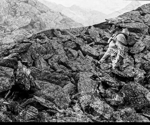
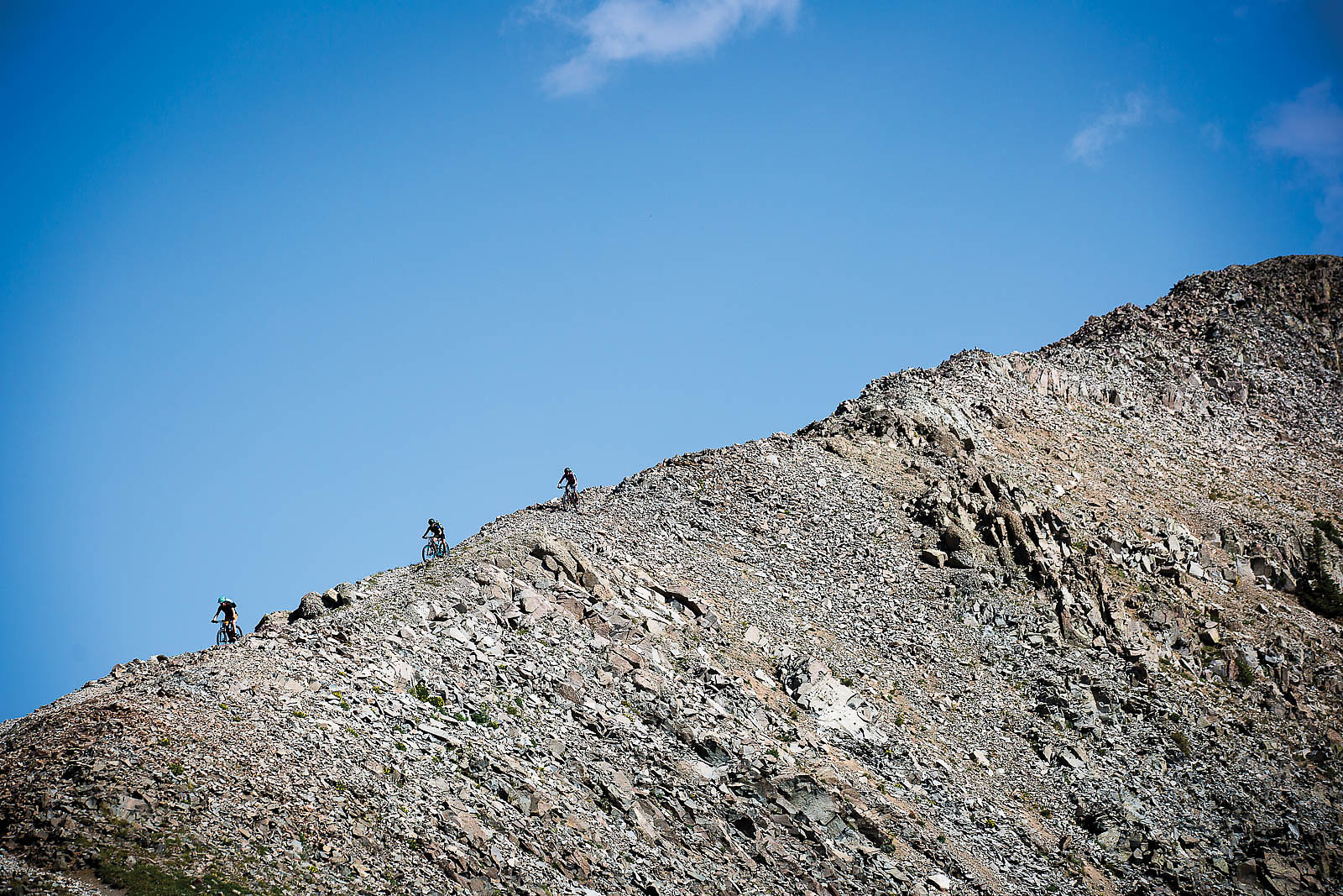
Watermelon-sized rocks shift and settle underneath our truck as it slowly crawls up the track. To the right is a sheer, thousand-foot incline, littered with mining debris and automobile bones; to the left a precipitous face of loose boulders and cliffs.
Barely clinging to the hillside ahead of us is a two-wheel-drive rental van, surrounded by a panicked German family. Our nerves in the truck cab are already frayed, and reversing down the half-mile of rough, chassis-scraping road behind us is not an option. Besides, the only pullout behind us is occupied by another vehicle escaping the traffic jam.
Chasing singletrack in Colorado’s San Juan Mountains takes its toll, on both vehicles and bodies. Many trailheads are only accessed by remote jeep roads, and you’re a long way from any sort of help or cell service. Hair-raising thunderstorms can arrive in a matter of minutes whatever the season, as can rain, hail or snow. Most of the routes have barely evolved from their mining, hunting and hiking origins, and there’s far more trail than maintenance. And above 10,000 feet, the altitude can quickly turn even the fittest riders into pieces of jerky.
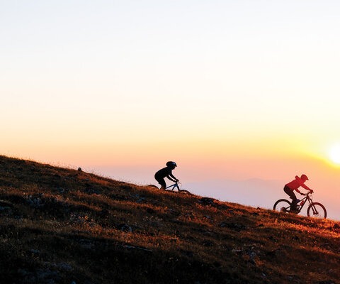
Among these obstacles exists some of the most remarkable trail in the lower 48. All-day epics are common, and the tumultuous weather is often offset by sunny and serene calm. Soul-crushing climbs lead to long descents, varying from Pacific Northwest loam to lonely, high-alpine tundra, or chunky, scorched rock.
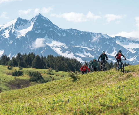
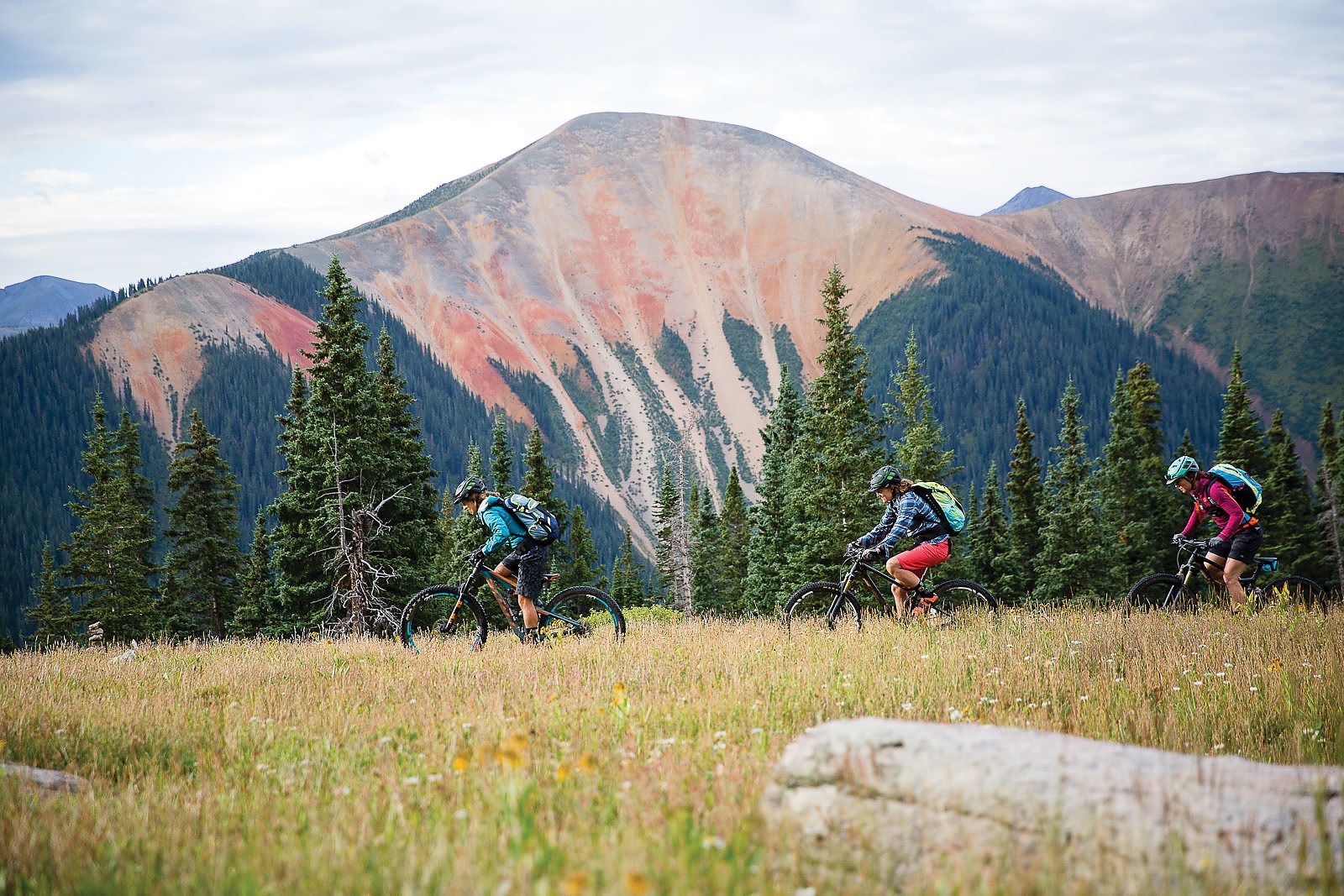
For our crew, made up of riders Sabina Kraushaar, Sarah Sturm, Teal Stetson-Lee and myself, this is somewhat of a reunion tour, four days of exploring our backyard. We know nothing here comes easy. And we also know—like Edward Abbey’s desert—wilderness cannot be truly experienced until “traces of blood begin to mark your trail.” Because no matter how much time you’ve spent in the San Juans, some things are guaranteed: You’ll usually suffer, and you’ll always be surprised.
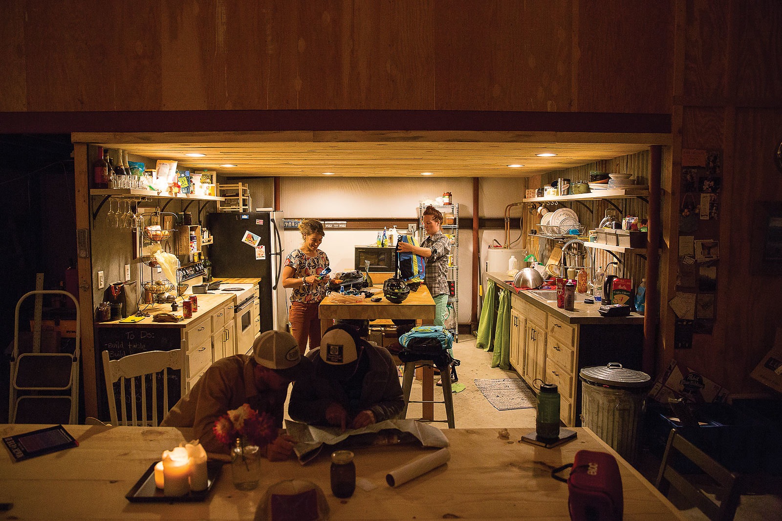
The tour began three days before the white-knuckle situation on the perilous mining road, at Sabina and her husband Mike’s barn in the Dolores countryside. It’s the perfect place to start a reunion tour, with plenty of room to pack, swill beer and tell stories long past our late dinner, which eventually led to a pitch-black wakeup call the next morning. Our first objective was Salt Creek, just outside the old mining town of Rico, and fog wreathed the trees along the Dolores River valley as we wound out of cell service. It is mid-August, but the truck’s outside thermometer reads 40 degrees Fahrenheit.
We parked and pedaled up Scotch Creek Road into the pinched valley, over rocky, wet roadbed, stopping to pluck fresh raspberries. It was the long, grinding type of climb typical of the area, and we finally topped out at the Colorado Trail, a 500-mile ribbon of singletrack running along the crest of the Rockies. Hazy, sunny views of blue mountains spread out in all directions, marching above the Hermosa Valley. To the east we could see the serrated peaks of the Weminuche Wilderness, an expansive backdrop as we worked long miles of the trail’s steep climbs and downhill fragments. There was not a structure or road in sight, the most complicated pieces of machinery being between our legs.
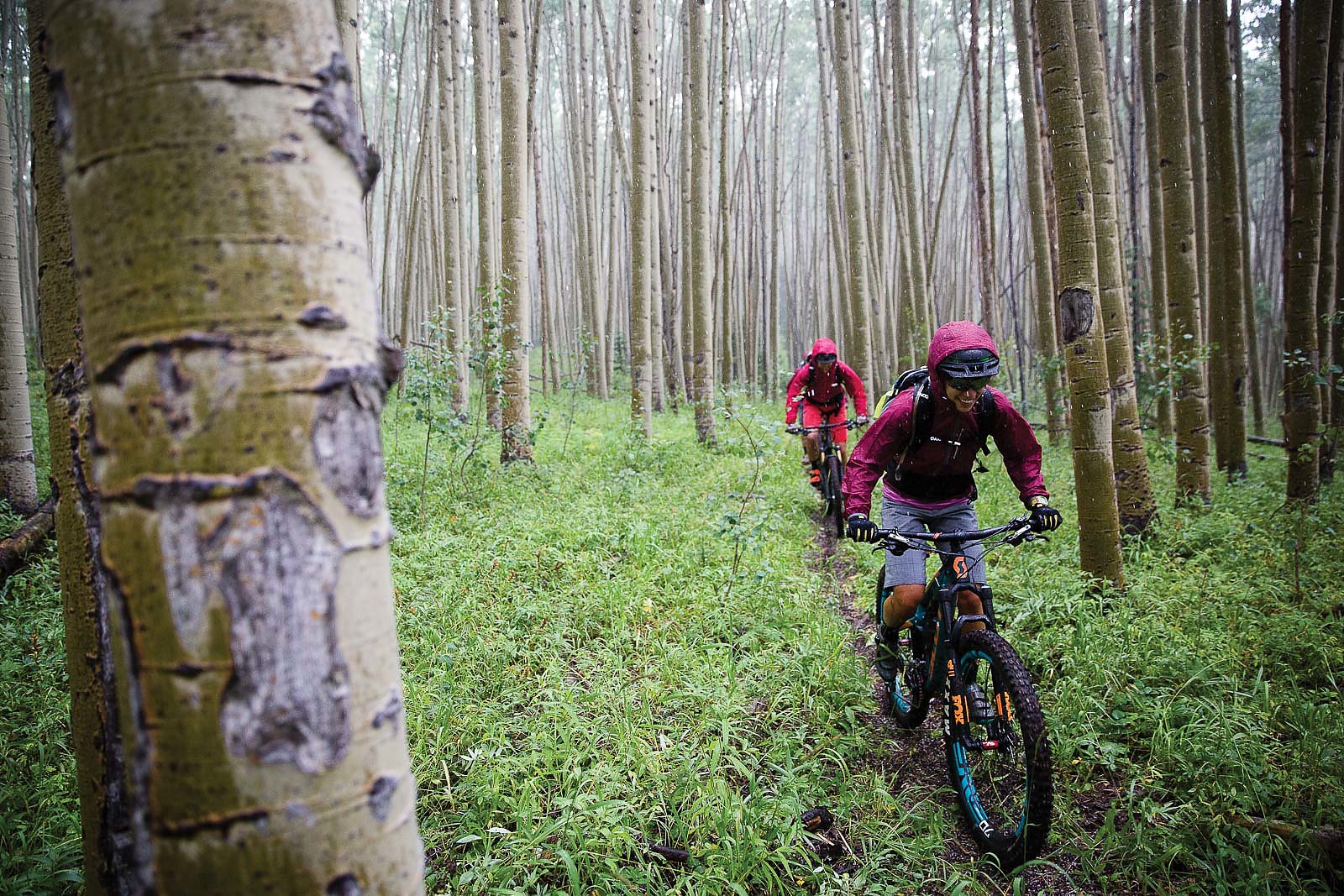
Our route eventually peeled off the Colorado Trail, down into Salt Creek and swaying aspen groves. A surge of wind, rain and hail washed over us and then was gone as quickly as it arrived. It was classic Colorado weather, which covered the rocks and red clay leading into the Dolores River Valley in a layer of grease, until we escaped into the canopy of the forest. By the time we reached the Enterprise Bar & Grill, about the only place you’ll see humans in Rico and definitely the only place you can get a burger and beer, the girls were still giggling.
Down the road from the Enterprise is a primitive hot spring, and, after 20 miles and 3,000 feet of climbing, it was the perfect place to soak our tired muscles before we met Mike down the road. After dropping off his Subaru for the next day’s shuttle, we all piled into the truck—five humans, five bikes, two dogs and a slew of gear—and drove to the end of Hillside Road. The fading sun lit up the distant skyline as we set up camp, the alpenglow eventually morphing into the blue glow of a full moon and our headlamps stabbing the darkness as we stuffed our bags and bellies. We had a long day ahead of us. We had to be prepared.
Beams of morning sun seared through the forest, burning off the fog as we huffed our way up the Hillside Connector and back onto the Colorado Trail. At over 12,000 feet the view of the smoky cobalt ridges that surrounded us were stunning, but our lungs struggled with the rollercoaster of false summits and punchy hike-a-bikes. Even on the following downhill it was hard to catch our breath as we crept through the rutted scree switchbacks and gauntlet of boulders to Taylor Lake.
The rest of the day brought no relief. Rather than the standard descent into Durango from the Kennebec Pass, we headed west onto lesser-traveled routes, continuing up to another 12,000-plus-foot pass before dropping into the Bear Creek drainage on barely navigable trail. Rocks, holes and handlebar-high skunk cabbage tore at us from every angle, thistles leaving fiery welts across our appendages. The smoother, lower-elevation stretches gave little respite—that only came when we slipped into the icy Dolores River at the bottom, soaking our nettle and thistle stings in the late-afternoon sun.
We continued our routine with another dinner at the trusty Enterprise, another pitch-black drive to another trailhead and another headlamp-lit tent set up, this time at the end of Eagle Creek Road. The original mission for the morning had been a long rally along the Calico Trail, but sections were under repair and closed for the season, forcing us onto alternative routes in the Rico Mountains. In the morning’s cold, dim light, we set out on a mostly unridable slog up the West Fall Creek Trail to where it meets the Calico.
Atop the ridge we met two hunters doing recon for the upcoming season, and, after a brief conversation, we snacked and took in the filmy, blue-green horizon under clear skies. The plan was to split the day into two parts: Bash our way down the rocky, rooty Eagle Peak Trail to Mike and his trusty Subaru shuttle, then head to the tiny hamlet of Ophir, where we’d creep up a jeep road to an alpine hut.
Little did we know the technical descent would prove to be the easy part, for the same time we were picking our way down the Eagle Peak trail a German family had just started creeping up a steep scree roadcut, unaware of the peril that lay ahead.
Back on the precarious old jeep track, it becomes obvious the van is stuck beyond the German family’s comfort zone. They’re not going anywhere without help, and so we pile out of the truck—mostly to assist other humans in trouble, partly because another truck is coming down the hill, and partly because we’re not going anywhere until the family moves.
After a bit of rock moving, rearview mirror directing, and an Austin Powers-esque, 30-point turnaround, we’re able to let the Toyota 4Runner squeeze by the van and our Tundra. With the road momentarily clear and the van pointing downhill, we scramble by and continue on our way to our final night’s accommodations: the Opus hut, a high-alpine refuge at the starting point of the most ambitious leg of the trip. It’s a quarter-mile walk to the hut, and upon pulling the truck into the trailhead we all take a moment to pack and let our nerves settle.
Resting just shy of 12,000 feet, the Opus is more of an Austrian chalet than a “hut.” The three-story-tall building sits on an old mining claim and is the product of herculean effort by proprietor Bob Kingsley. Kingsley acquired the claim in 2005, and spent five years mortaring the stone foundation, constructing the timber framing out of salvaged barn beams, and building the impressive accompanying sauna. The result is a fully off-grid oasis, stocked with booze and food and capable of hosting dozens.
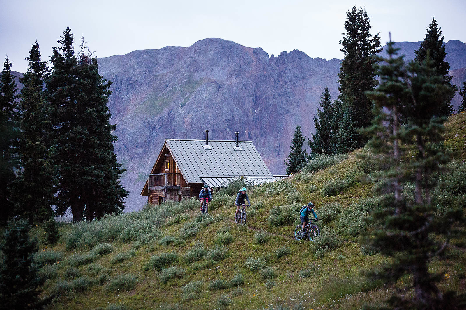
Kingsley is as capable a host as he is builder, and we sip tea and take in the views as he cooks a meat pie in his homemade Dutch oven. Tomorrow is going to be a big one—the plan is to navigate and bushwhack the Wasatch Trail, a descent that spills out into the mountain town of Telluride. First, we must get there, and we are all beat. Luckily Kingsley’s hospitality puts the entire group at ease.
At 5 the next morning, we awake to the smell of Kingsley cooking us a hearty kale, egg and bacon breakfast, and we begin frantically chowing and packing to get out as quickly as possible. The forecast is looking rough, but Colorado weather is predictably unpredictable. We decide to continue with the mission. We’ve made it this far.
A faint mule trail climbs off to the east, paralleling Highway 550 a few thousand feet below. The route continues into a verdant tundra basin before forking onto the Columbine Trail and a stout hike-a-bike to a ridge summit at 12,500 feet. It’s brutal but beautiful, echoing the vast, open greenery of places like Iceland or Ireland. The similarity doesn’t end at the landscape; dark clouds billow toward us, promising some form of inclement weather.
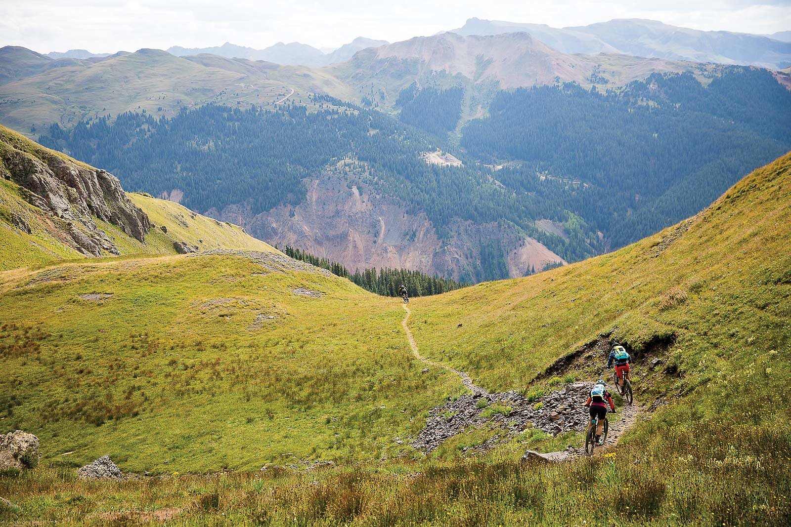
The weather forces us to make a decision: We’ve barely put a dent in our big day, and from here until the final descent we’re hovering between 12,000 and 13,000 feet in open, lightning-prone tundra for multiple hours. We want to push on, but the trip has us tattered, and we know such thunderstorms can be lethal.
The choice is obvious but difficult—safety wins out over ego, and we decide to turn around and explore the Columbine Lake Trail descent. We’d written it off as a hiking trail, but its brake-pad-searing steeps, poppy root sections, thin benches and spicy switchbacks have us gripped to the trail’s end. The storm is soon roiling overhead, and we race raindrops up a nearly four-hour, granny-gear climb back to the safety of the Opus.
We arrive just as a bank of clouds swallows the surrounding peaks, and soon snowflakes are melting against the windows. As the storm swirls we’re back in the truck, creeping down the bumpy road. We’ve been defeated, but that’s OK—sometimes the best rides are the ones you don’t finish. As Abbey put it, “May your trails be crooked, winding, lonesome, dangerous, leading to the most amazing view.”