A Frontier Feeling Off the Radar in Scotland
It comes from my right, an explosion in the trail-side bushes that puts my heart into my throat.
I jump aside, and my surprise fades as a ruffled grouse, one of the many bird species native to the area, flutters off into safer foliage. I know the area’s only natural predator is a 10-pound wild cat, but when you’re someplace that feels this remote, it’s impossible for the imagination not to wander.
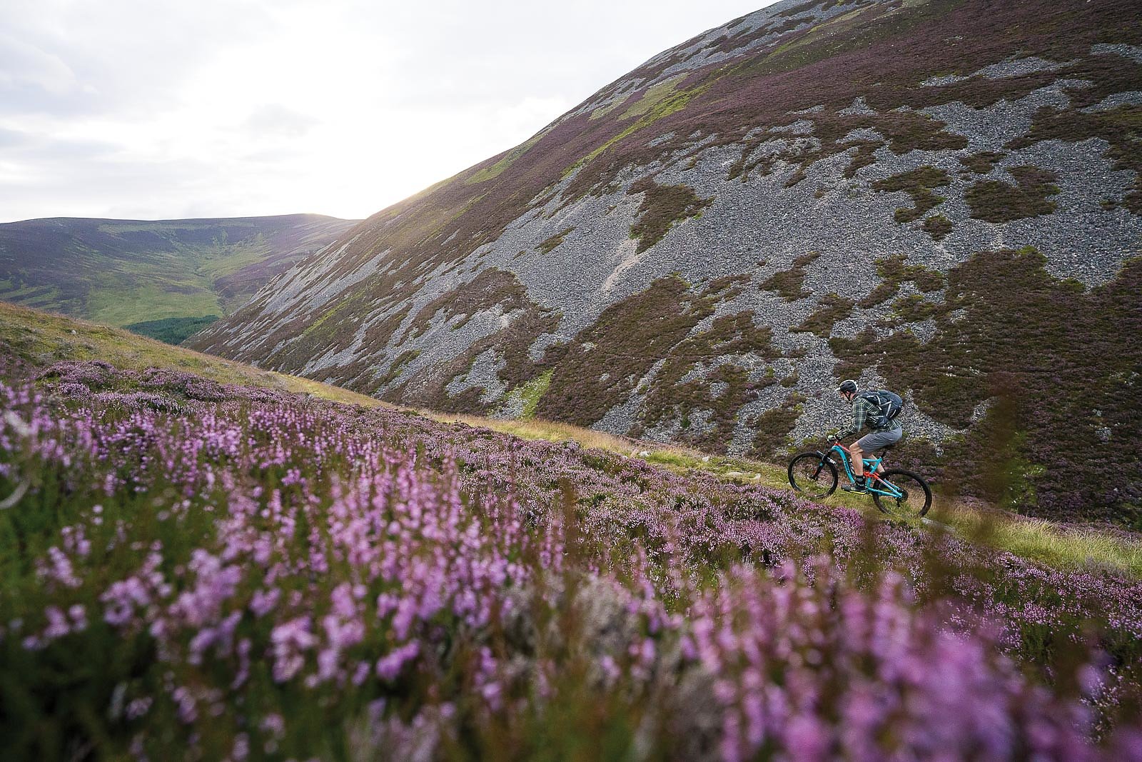
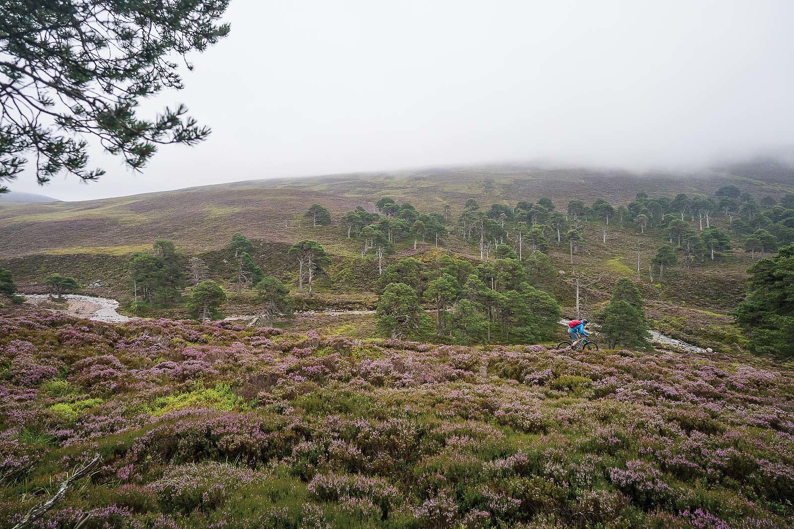
While the fauna isn’t dangerous, I’ve been well-warned that the weather is. I’m 15 minutes into my first ride in the Central Cairngorm Mountains, just five miles as the crow flies from the nearest village, and there’s no sign of civilization besides this narrow thread of singletrack, barely visible as it disappears into the scabrous, heather-clad mountains ahead.
My husband and I arrived in Scotland less than 24 hours before, on a self-guided mission to explore the network of trails outside the small town of Braemar. Home to just under 1,000 people and multiple castles, Braemar is located along the River Dee, in the craggy mountains of the Scottish Highlands. The peaks aren’t dramatic, but they are the tallest—and coldest—in Scotland, an area of stunning views with an ever-present frontier feel.
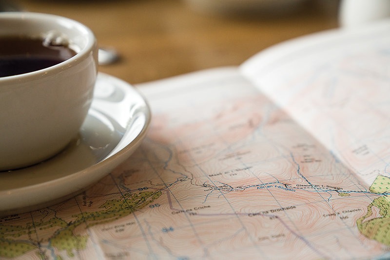
It’s perfect terrain for mountain biking, but as Andy McKenna, owner of Go-Where Scotland, informed me while I was planning this trip, it isn’t for the ill-prepared. The terrain is deceptive and can be quietly treacherous, and over the phone a few days earlier he suggested I stop at Braemar Outdoor Sports to buy the proper topo maps. “Also, please keep track of the weather,” he added. “You don’t want to get trapped if the rivers rise too high to cross.”
The forecast calls for rain, and I ask what they recommend for wet riding options. “The road,” Guy says, with a wry smile.
The next morning, we heed his advice, stopping at the outdoor shop for forgotten gear, navigational devices and a cup of black tea and plate of scones. Between beverages and pastries, we meet Eck, Guy and Lee, three locals whose visual hardiness is matched by their welcoming nature. We introduce ourselves and chat about the area, and upon learning of our plans, the trio crowds around the map to give advice and input. The forecast calls for rain, and I ask what they recommend for wet riding options. “The road,” Guy says, with a wry smile.
The sarcasm is expected and well-intentioned, as Lee already informed us that Guy is a friendly cynic. He’s also a local legend, an experienced rider known to regularly make the 20-plus-mile commute across the mountains to work.
I shrug and Guy laughs, and then begins highlighting the routes McKenna recommended, as well as some of his own suggestions. He taps a cluster of topo lines with his finger. “It would be great if you made it this far,” he says. “There is a beautiful forest, a unique feature of the landscape. You’ll be surprised.”
We reach the forest a few hours later, and we’re more amazed. The three-mile swath is part of the Caledonian Forest, a centuries-old woodland of ancient birch and pine, one of the only remaining such forests in Britain. The trail alternates between cushy loam and slippery, gnarled roots, and we decide to stop at the Caledonian for lunch. This is the halfway point for the Gleann an-Slugain route, an all-day affair with multiple river crossings and delightfully narrow singletrack.
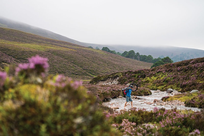
We spend the rest of the ride looping through vast stretches of rock and heather, climbing over low mountain passes and winding by lakes so dark the waters seem black. The maps are crucial, as the landscape becomes backcountry the instant you leave town, and crossing the tributaries of the River Dee is frightening even on lightly raining days. McKenna’s warnings take on new validity, and Guy’s sarcastic comment soon becomes reasonable advice.
The loam and scenery continue, and the forecasted rain holds off until we reach the paved road back to town. We’ve spent the afternoon imagining a cask-ale and hot pub meal, but it’s not available when we get to Braemar. The alternative, a heaping plate of traditional, deep-fried black pudding and chips, is still delicious. If there’s one constant in Scottish culture, it’s that the food is as hearty as the people and adventure.
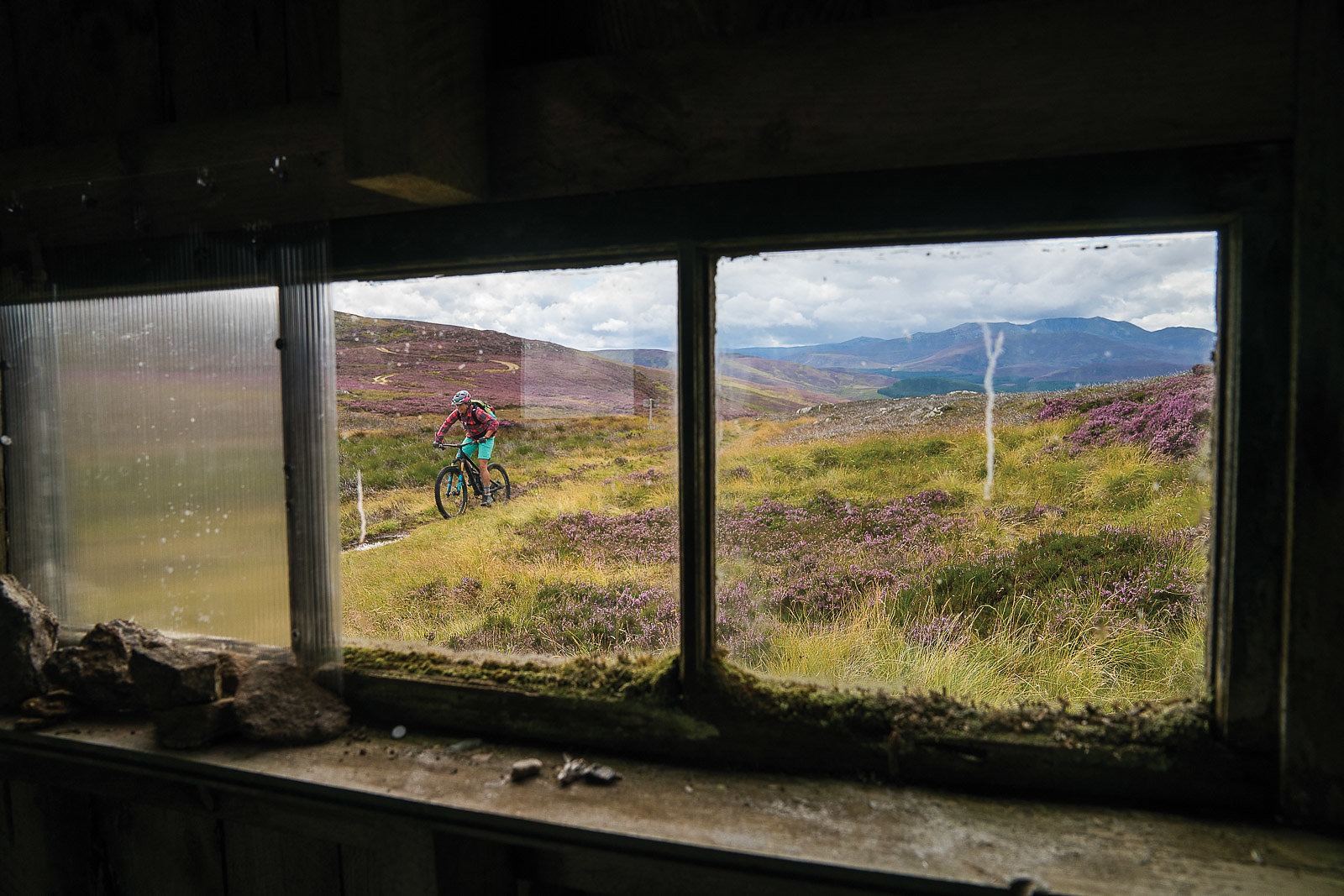
On our final day of riding, we choose to head toward Heartbreak Ridge, another multi-hour web of unrefined Cairngorm singletrack. Here we discover a quintessential feature of the Scottish Highland lifestyle: The bothy, a tiny stone structure that provides shelter from the unpredictable weather. Bothies are common across the United Kingdom, and can be as established as a quaint cabin or as basic as a rock-pile hut. This particular bothy is simple and ascetic, and makes a perfect place for a snack break and map check before continuing on.
The following miles are a mash-up of technical and playful, with flowing grassy sections leading to granite slabs and slickrock. The weather clears as we near the trailhead, partly blue skies adorned with a full rainbow hanging in the distance. We snap a few photos before heading back into town.
McKenna referred to Braemar as “off the radar” compared to better known areas like Aviemore and Torridon, and said they’re still exploring the numerous possibilities hidden in the Cairngorms.
"You can very quickly be knocking on the door of some of the biggest mountains in the UK,” McKenna told us. “You won't have to go very far from Braemar to feel like you’re really out there.”
After just three days, I fully understand. My husband and I spend the evening reminiscing over a hot pub meal, letting our imaginations wander as we sip on a celebratory round of fresh ale, straight from the cask.